This article is featured in the 2026 Freshman Special Issue.
Long before Dartmouth students walked the banks of the Connecticut River or hiked the trails of Mount Cardigan, the land that eventually would become the Upper Valley was caught in the breakup of Pangea, the supercontinent that once joined Earth’s landmasses.
Over millions of years, tectonic shifts, volcanic activity and glaciation transformed the landscape, sculpting the rivers, mountains and forests dotting Vermont and New Hampshire. Today, these geological features serve as “preserved natural history” for students to discover and learn more about earth and environmental sciences, earth and planetary sciences professor Meredith Kelly told The Dartmouth.
At Dartmouth, students can study the earth and its environment through the earth and planetary sciences and environmental studies majors. EAPS professor Edward Meyer said in an interview that despite “some faculty who overlap,” the two departments differ in that EAPS focuses on the Earth’s physical processes, while environmental studies analyzes the intersection of environmental policy and science.
Both programs benefit from Dartmouth’s historically significant geography. For Kelly, who researches the historical record of climate change, the College is situated in “a geologically very interesting place.”
Dartmouth is “within the Appalachian Mountains, which is a really old chain of mountains that formed about 400 million years ago,” Kelly said. “But the rocks right below our feet at Dartmouth and nearby tell us about how those mountains were formed and essentially how North America was built over time.”
About 200 million years ago, tectonic activity split Pangea, separating North America and South America from Europe and Africa with the rift that eventually formed the Atlantic Ocean, according to Kelly. During this process, a failed rift valley split New England into what is now known as the Connecticut River.
“Initially, the rift was pulling where we are in Hanover eastward,” Kelly said. “If that rift had continued where the Connecticut River is, we would be over in Africa and Europe, and New Hampshire and Vermont would have coastal real estate.”
Approximately 20,000 years ago, the last ice age covered New England in a mile-thick glacial sheet, according to Kelly. As the ice sheet melted and retreated northward, the Connecticut River Valley “acted like a bathtub,” she said. Today, flat areas around Dartmouth, such as the Green and the fields at the Corey Ford Rugby Clubhouse, are sediments that were part of the last ice age’s glacial lake.
“You can literally dig right below campus and find these beautiful sediments that were deposited at the end of the last ice age,” Kelly said.
One of Kelly’s research projects focuses on how and why the ice sheet that covered Hanover and northern North America deglaciated. By analyzing the pollen, insects and geochemical components found in sediment cores, Kelly is able to map the “rapid climate change” that occurred in the Upper Valley to help “put together a picture of global climate change in the past.”

“I basically use glaciers as a past thermometer on the planet, so we can tell when times were warm and cold,” Kelly said.
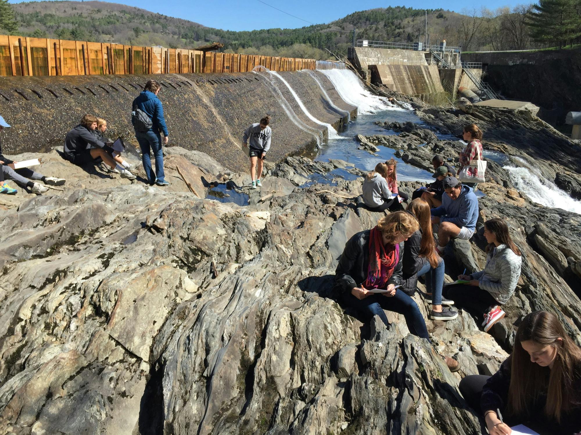
EAPS and environmental studies professors often incorporate field trips and outdoor exploration into the Upper Valley into their courses. According to Meyer, typical field trips in the introductory Earth and planetary sciences course, EAPS 1: “How the Earth Works,” includes going to the Mink Brook Nature Preserve to study flooding and river management.
Meyer said some lab assignments in the course include a walking tour of campus and Pine Park to observe evidence of volcanic activity, bedrock and sediments as students “unravel the deeper time story of the Hanover region.”
“It really drives home the fact that this is a landscape that has evolved in pretty dramatic ways,” Meyer said.

Outside the classroom, Dartmouth offers opportunities to research climate change and sustainability using campus lands and data through the Dartmouth as Living Lab program. DaLL program manager Simone Whitecloud said the program allows students, faculty and staff to engage with and learn about Dartmouth projects, datasets and land related to sustainability.
“I help people to access Dartmouth lands,” Whitecloud said. “We’re the fourth largest landowner in the state, and we have 27,000 acres up at the Second College Grant, so people can see what properties we own and I also help people access data.”
This year, the program plans to do a controlled well drilling in the spring to extract 150 feet of sediment above approximately 650 feet of bedrock. These sediments will be used by students, faculty and community members for study and observation.
“We plan to try to make this available to not just earth science students but to the Dartmouth community as a whole because it’s a rare opportunity that we want to take advantage of,” Whitecloud said.
Similar to DaLL, the Energy Justice Clinic at Dartmouth offers community-based research opportunities, bringing together Upper Valley community partners, such as the Sustainable Hanover Energy Subcommittee and the Hartford Energy Commission, with faculty and students to study energy insecurity, renewable energy development and flooding.
Clinic co-founder and head Sarah Kelly, who is not related to Meredith Kelly, said one of the organization’s main projects concerns low housing stock and the growing fuel costs of heating drafty homes, both of which impact energy insecurity, in rural communities. Kelly said Dartmouth is “recognized for having an expertise” in rural and cold regions because of its location and is uniquely positioned to study and support energy justice issues affecting New England.
“There’s great opportunities for students to get mentorship to understand these issues in a really interdisciplinary way,” she added.
Currently, Kelly’s research focuses on the Rural Rivers Project that studies flooding in the Upper Valley. Due to many Vermont towns’ location along the Connecticut River, the state has experienced “particularly intense” flooding for the last 10 to 15 years, Kelly said.
Kelly primarily conducts research and outreach with Vermont communities to study and address flooding.
“We do community-based research with communities in the Black River Valley, the Black River Action Team, Cavendish Connects and in Hartford to study flooding, but also to map community response and to provide different tools to build community resilience,” Kelly said.
For students, that work offers a way to engage with the environmental challenges shaping the Upper Valley by working alongside the communities directly experiencing them.
“It’s good for students to just get involved in whatever way is accessible to them in these environmental and social issues,” Kelly said. “Becoming an active member of the community is a great way to confront climate anxiety and to create hope.”
Kailyn Holty ’29 is a news reporter from Redwood City, Calif., and is majoring in economics and quantitative social science.